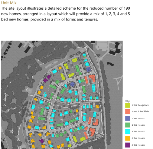
Our Proposals
Our proposals are now for 190 units which is a reduction in unit numbers when compared to the original scheme.
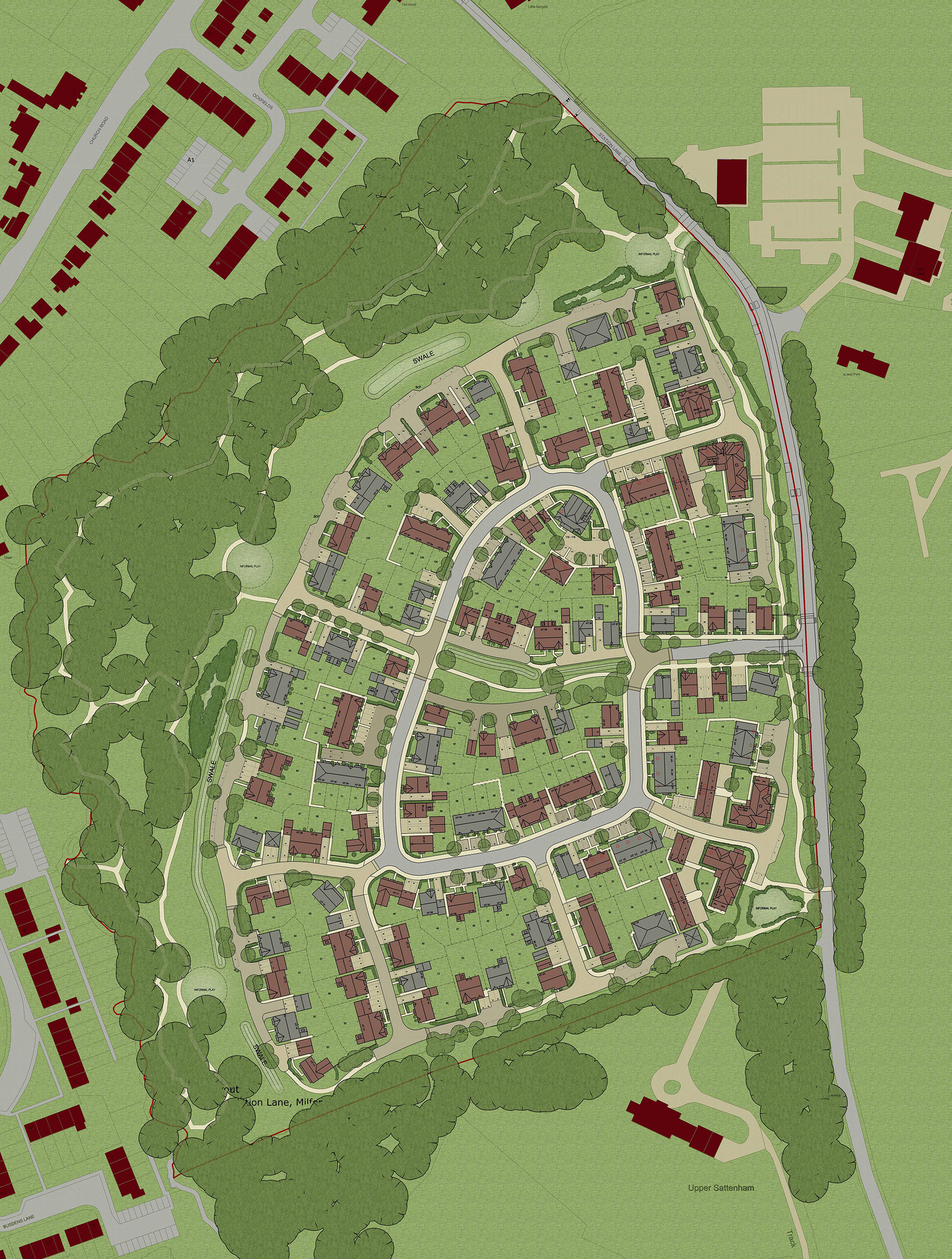
- 190 attractive family homes (30% affordable housing) comprising a wide mix of units and a number of bungalows
- Associated landscaping including the provision of 5 informal play areas that will encourage natural play
- Enhanced connectivity for pedestrians and cyclists, including a pedestrian link to Busdens Way and a north-south shared pedestrian/cycle link along the eastern boundary of the site
- Retention of the vast majority of existing mature trees, complimented by additional planting and open spaces
- An area of Suitable Alternative Natural Green Space, which will provide attractive routes for walking
This site is ideally suited to provide much needed family homes in the borough, located in close proximity to Milford Railway Station and within walking distance to local shops and restaurants.
Waverley Borough Council’s Local Plan, which covers the period to 2032, seeks to deliver 11,210 dwellings equating to an annual average of 590 dwellings between 2013 and 2032. The site is identified as a preferred location for housing in the adopted local plan.
Landscaping
The evolution of the landscape scheme has sought to focus on the retention of the existing woodland and boundary vegetation whilst providing a quantum of new tree, hedge and shrub planting.
The open spaces are an integral part of the overall design concept and we have designed them in conjunction with the architecture to create a series of individual character areas adding to the overall variety.
Please look through the virtual exhibition for further details on our proposals.
Flood Risk Mitigation
All floor levels of the properties within the development are raised to a minimum of 600mm above the maximum modeled 1 in 100 year flood level including an allowance for climate change.
This ensures that the properties on site are protected from flooding for the lifetime of the development.
In addition to protecting the development itself from fluvial flooding, measures have been taken to ensure the development proposals do not increase flooding risk elsewhere.
Access & Highway Design
As part of the outline planning approval careful consideration was given to a package of off-site works to enhance sustainable access to and from the development. These agreed enhancements were carefully reviewed and agreed with Surrey County Council, as highway authority.
The measures include:
- Enhancements to crossing facilities at the Portsmouth Roach/ Church Lane roundabout junction
- Widening of the existing footway on the eastern side of Station Lane from Springwood south
- Widening the junction at the Church Lane/ Station Lane priority junction
- Implementing traffic calming measures along the entire length of station Lane, in the form of speed cushions at regular intervals along the road
- Delivery of corridor through the development from Station Lane to the Western boundary of the site
- A commitment to fund a speed limit reduction from 40mph to 30mph from the rail station northwards to the village on Station Lane
- New informal crossing points at the development site access
- Widening of the existing footway on Station Lane up to 1.8m from the south-eastern corner
- The extensive package of agreed mitigation measures will deliver a material enhancement to access along the Station Lane corridor for all users, not just the end occupiers living at the site. These measures are fully supported by SCC, as highway authority, as confirmed through the outline planning approval.